

The kick of citizen science: ‘It's a kind of addiction’
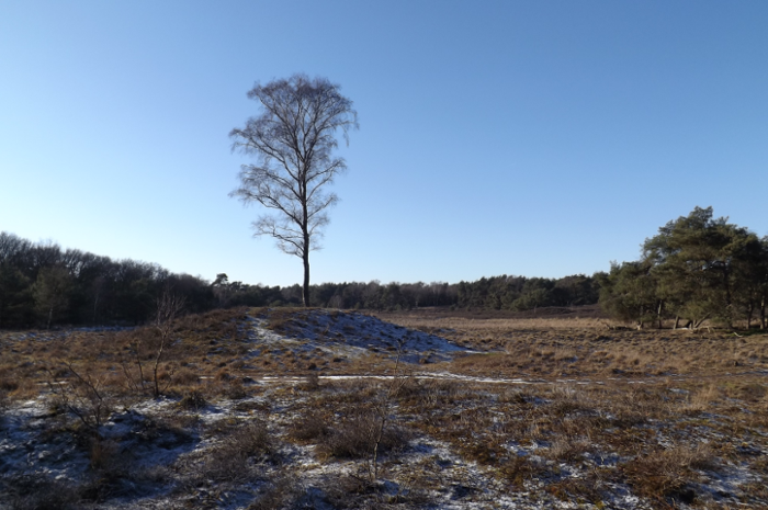
Leiden archaeologists appealed for help from volunteers to search for archaeological remains on satellite images of Utrechtse Heuvelrug, a national park close to Utrecht. The outbreak of the corona virus made the project a resounding success: in a single month, all 300,971 maps had been examined. 'That's more than I could have hoped for in my wildest dreams.'
He’s seen over 20,000 maps in recent weeks, says Sander Hunink from Oss. In his everyday life he’s an ecologist, specialising in nature legislation in the Netherlands, but, time permitting - in his coffee or lunch break - he likes nothing better than sitting at his computer, hovering over Utrechtse Heuvelrug and surveying the scene in an imaginary helicopter.
Hovering over Utrechtse Heuvelrug, in an imaginary helicopter.
Hunink is one of the thousands of volunteers taking part in Heritage Quest, a citizen science project being carried out by Leiden University and Landscape Heritage Utrecht, a conglomeration of heritage organisations. The volunteers search detailed elevation maps for remains of prehistoric civilisations on Utrechtse Heuvelrug. Many of these remains can be recognised from subtle differences in height in the landscape: these could be such features as burial mounds, Celtic fields and ancient cart tracks (see below). The volunteers work from home, at their own computers. This makes Heritage Quest the first large-scale archaeological citizen science project in the Netherlands.
Burial mounts
Used as: graves for several bodies, mainly from the second and third millennia BC.
Can be recognised from: slightly raised circular areas (ca. 1-2m high and 15m wide)
Celtic field plots
Used as: plots for fields of ca. 40 x 40 metres from the Iron Age.
Can be recognised from: grid pattern of low, broad ramparts (30 cm long and three to four metres wide) surrounding lower areas (the field plots).
Remains of cart tracks
Used as: routes for transporting people and goods.
Can be recognised from: deep, broad and long furrows (ca. 50 cm deep) parts of which are still clearly visible.
‘It’s a healthy kind of addiction,’ says Hunink over the phone. ‘In a short coffee break I can look through a few charts. It’s fascinating: am I going to discover something on the charts this time? Is what I’m seeing right? And it’s quite satisfying to be faster than the other volunteers, and to be the first to detect that burial mound.’
‘It would never have been possible without all these volunteers.’
And Hunink is by no means the only person to think this way. On Monday 6 April, when the first 1,500 charts of Utrechtse Heuvelrug were put on line, volunteers set to work en masse. Within 24 hours, every chart had been viewed at least 30 times. In the same period, some 3,000 people visited the website, and the visitor numbers are still excellent. ‘I think it’s fantastic,’ says archaeologist Quentin Bourgeois, who is heading the project on behalf of Leiden University. ‘It’s beyond my wildest dreams that there’s so much interest in the project. Within just a month, all 300,971 charts had been examined. That would never have been possible without all these volunteers.’
Bourgeois thinks that the coronavirus outbreak has played a role in the huge success of the campaign. ‘In recent weeks we’ve all been at home a lot of the time, and people naturally look for something to do to fill the time.’ The success of the previous campaign organised by Heritage Quest also added to the success. In that campaign volunteers searched for archaeological remains on the Veluwe, a forested area in Dutch Gelderland. Thanks to the previous experience, the project is now better known.
Hunink also took part in the Veluwe project, he explains. Thanks to the experience he gained then, he has now developed a sixth sense for recognising interesting places on the elevation charts. With the Veluwe project, he would spend several minutes looking at each chart, but now he can generally see in a few seconds whether there is anything to be discovered there. If he’s in doubt, he makes a note on the forum, so that other volunteers and archaeological guides can give a second opinion.
‘The Veluwe used to be my back garden. Now I’m helping unravel its history.’
The detective work on the Veluwe changed the way Hunink looks at the region. During the project he discovered – together with other volunteers – many more burial mounds than expected. In prehistoric times, the Veluwe was probably much more densely populated than people had assumed, a piece of news that was picked up by the local media. Hunink: ‘At one time I lived in Rheden, and the Veluwe used to be my back garden. Now I’m helping unravel its history. I’m part of the start of a discovery, which is fantastic.’
Text: Merijn van Nuland
Children are also joining in the search
The project for adults has now come to an end, but children can still help. The Junior Heritage Quest (in Dutch) project was launched on Monday 20 April . The project was developed together with the Cultural Heritage Agency of the Netherlands. Children aged between 8 and 12 can help by making an online search for archaeological remains on the Veluwe and possibly discover new burial mounds and prehistoric land plots. These junior archaeologists are making a valuable contribution to scientific research.