Research project
Urbanism and municipal administration in Roman North Africa
This project uses archaeological, literary and epigraphic evidence to investigate urban development in Roman-period North Africa, compiling this in a GIS-linked database in order to analyse the development of urban settlement spatially over time.
- Funding
-
 European Research Council

 The project researches the urban centres of Roman-period North Africa, exploring patterns in their development by compiling a GIS-linked database of their attributes. The database will then form a tool of analysis for mapping various urban phenomena, which will help to answer questions regarding social and economic integration and the causal factors behind the process of urbanisation.
Description of the project
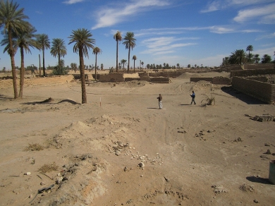
A multitude of different types of urban or proto-urban community existed in North Africa from the destruction of Carthage in 146 BC right up to the Vandal conquest. Many urban centres were transformed in character during an urban building boom of the late 2 nd and early 3 rd c., due in no small part to North Africa’s agricultural prosperity and the harnessing of that prosperity by a class of municipal élites. Since major archaeological atlases of Algeria and Tunisia were compiled during the colonial period, no fully comprehensive attempt to catalogue and categorise these sites, and to understand the processes behind urbanisation, has been attempted. A greater emphasis was placed in the past on mapping the towns which possessed a specifically Roman character, with municipal charters based on the Roman model (the various municipia and coloniae of the empire). Over 500 named civitates are also known from North Africa, although the problems of creating a definitive list of the official towns by rationalising those provided by the many thousands of Latin inscriptions and the episcopal and geographic sources are usually thought to be insurmountable.
The process of cataloguing and dating the municipia and coloniae of North Africa has been greatly advanced by the work of J. Gascou, while the recent Barrington Atlas of the Greek and Roman World and the newly updated edition of P. Salama’s map of the roads of Roman North Africa also provide crucial starting points. The latter is accompanied by a detailed and well-referenced catalogue of some 364 official towns, but the size of the map has been reduced to cover only eastern Algeria, Tunisia and north-west Libya. The Barrington Atlas provides full coverage and key bibliographical information on each of its settlement sites, and its coordinate data have usefully been made available through the auspices of the Pleiades project. Separating officially recognised urban communities from large rural settlements, or sites displaying elements of urbanisation from simple villages, however, remains difficult. This project aims to use the full range of available data, literary, epigraphic and archaeological, particularly the surveys undertaken from the 19 th c. to the present day, to compile crucial information on the size, monumentality and date of North Africa’s various towns. This study of both the manifestations of, and causal factors behind, North Africa’s Roman-period urbanisation is part of a much larger ERC-funded project, which aims to comprehensively catalogue the urban sites of the entire Roman Empire.