
Research project
Detection of Archaeological Sites in High Resolution Satellite Images
In this project we develop algorithms to automatically detect a particular type of archaeological sites in satellite images of the Alps.
 Interreg IV
Archaeological prospection is a challenging task in areas that are largely unexplored, vast, and difficult to access, such as mountainous regions. Remotely sensed data, e.g. aerial and satellite images, can help to visually explore the area of investigation prior to fieldwork, but this work is time-consuming and error-prone as well.
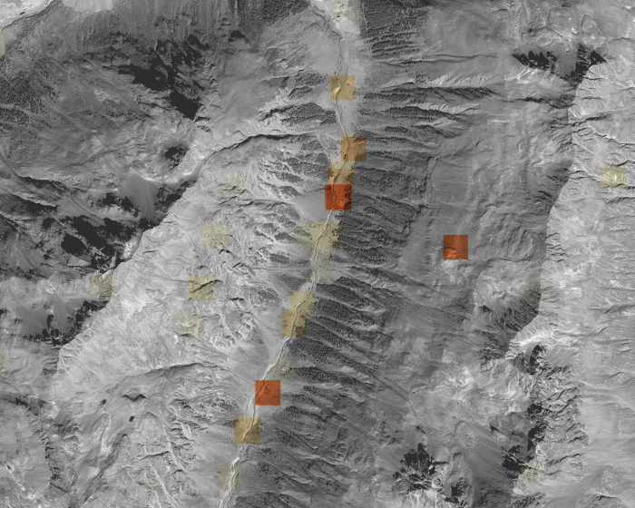
We use a recent archaeological project in the Silvretta Alps, on the border between Switzerland and Austria, as a case study to develop automated approaches to archaeological prospections based on remotely sensed data. The Silvretta project investigates the origins and evolution of pastoralism in the alpine zone above the tree line, of which archaeological remains of livestock enclosures are important indicators. Building on recent advances in digital image analysis, pattern recognition and feature detection, we develop algorithms that allow the automated detection of such enclosures in aerial and satellite images with 0.5m resolution. After image segmentation to exclude forested and urban areas, we use morphological operators to highlight linear structures in the images. Using geometric constraints, we then identify potential configurations of linear structures that may form enclosures. These configurations are then assigned a probability measure indicating the likelihood of the structure being an enclosure. The algorithm produces a map indicating locations of possible enclosures that can be used to guide archaeological fieldwork.