
Research project
Landscapes as networks
Modelling supra-regional communities in the early 3rd Millennium BC
- Duration
- 2015 - 2018
- Contact
- Quentin Bourgeois
- Funding
-
 NWO
NWO
Short abstract
This project aims to investigate the landscape organisation of Corded Ware groups during the early 3rd Millennium BC. It’s goal is to develop new perspectives on the spatial organisation of these supra-regional groups through computer simulations and network analyses.
Research question
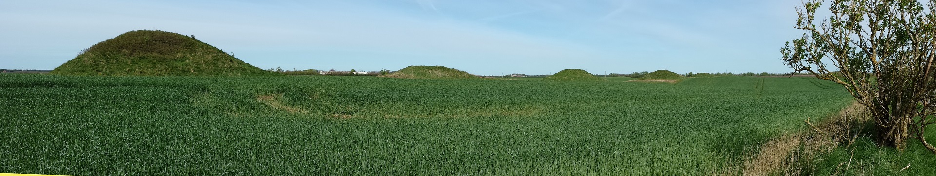
The burial tradition of Corded Ware groups found all over north-western Europe in the early 3rd Millennium BC is highly standardized. But how were these groups able to maintain such a strikingly rigid and homogeneous way of burial over such large distances?
Project description
This project investigates the landscape organization of Corded Ware groups in north-western Europe during the 3rd Millennium BC. It argues that this – often overlooked – organization of space is crucial to understanding the emergence of such pan-European groups. Its primary aim is to provide a new perspective on the organisation of the landscape in this period.
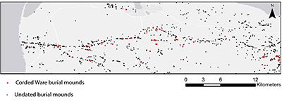
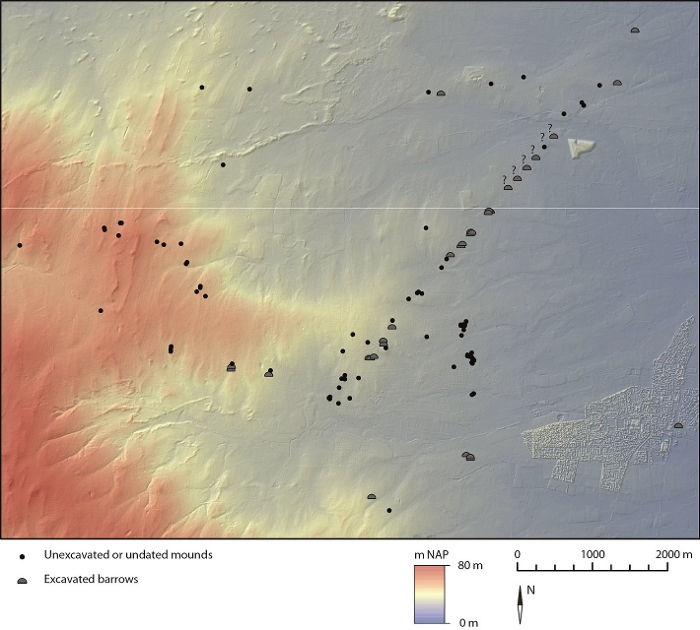
It will do so by studying two principal subjects and by applying and combining several novel approaches. Firstly, the physical network created by the kilometres-long evocative barrow lines will be studied through intervisibility patterns combined with a network-analysis. Secondly, the highly standardized burial ritual of these Corded Ware groups will be explored through a praxis-based network-analysis. Combining both analyses will reveal how Corded Ware communities organized the landscape.
The results of this project will then be used to develop a series of best practices to better protect the remains of the physical supra-regional networks of the period and to better visualise these long alignments of funerary monuments for the general public.
Three main sub-projects will address the following issues:
1. How long barrow lines structured the landscape into a physical network.
2. The emergence of a conceptual network where group affiliation was expressed through a widely shared and highly standardized burial ritual.
3. The organization of the social landscape of Corded Ware groups.
A fourth side-project is aimed at the dissemination of the results to the wider public and will address the following issue:
4. Developing best practices aimed at protecting the networks of barrow lines and how to better visualise them for the general public.