

A busy early summer for the SETinSTONE team at Salamis, Athens, and the Argolid
In June 2016, Dr. Ann Brysbaert and her SETinSTONE team were invited to participate in the fieldwork training season on Salamis island in Greece.
The salamis project: field training
The SETinSTONE project aims to assess how monumental building activities in Late Bronze Age Greece impacted on the political and socioeconomic structures of the Mycenaean polities in the period between 1600 and 1100 BC, and how people responded to changes in these structures. In this context, the team members of SETinSTONE are investigating both architectural features and local past economies in the region of the Argolid, Greece. While there may not be an obvious chronological or geographical link between the Salamis Project and SETinSTONE, methodologically, they employ very similar field techniques and that is why both projects teamed up this summer.
Salamis is of course best known due to its legendary naval battle which took place between the island and the mainland in 480 BC, between an alliance of Greek city states (under Athenian leadership by Themistokles) against a massive Persian fleet led by King Xerxes, and which was won victoriously by the far-outnumbered Greek troops.
This exciting new collaborative project under the joint directorship of Dr Stella Chrisoulaki (Ephor of West Attica, Piraeus and the islands) and Dr Jari Pakkanen (director of the Finnish Institute, Athens) will be carried out over five years (2016–2020). The project’s initial aim is to concentrate on mapping the visible existing remains of the harbour town of ancient Salamis which is currently on dry land at Ambelakia Bay, and to find out which geophysical methods can be effectively used to record the sub-surface remains. The Salamis research team aims to find out the location of the civic centre of the town, where the agora and the monumental buildings were and if it is possible to detect the locations of the sanctuaries mentioned by Pausanias (1.35.3 and 1.36.1)? The team also wishes to discover whether the Classical town had a ‘Hippodamian’ grid design, and, if so, what the dimensions of the city blocks and the house plots were, and what the widths of streets may have been?
In order to obtain answers the practical work carried at Salamis formed the perfect training ground in the employment of the techniques also needed by several team member of SETinSTONE in order to conduct their own individual fieldwork in the coming seasons. Therefore, the three PhD students - Ms. Riia Timonen, Mr. Yannick Boswinkel and Mr. Daniel Turner - joined students from the Finnish universities at Helsinki and Turku in both the geophysical prospection and the three-dimensional archaeological documentation training as part of the fieldwork. This fieldwork training season was financed by private donations from Finland and training funds of Dr Brysbaert’s ERC-funded project.
Intensive Leiden involvement
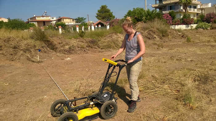
Ground penetrating radar, electrical resistivity and magnetometry techniques were tested and used in a complementary way for the geophysical prospection of the research area. Emphasis was on detailed mapping of the sub-surface features of the investigated areas and the layout of the geophysical grids was georeferenced using total stations. The geophysical prospection is directed by Dr Apostolos Sarris of the GeoSat ReSeArch Lab of the Institute for Mediterranean Studies of the Foundation for Research and Technology, Hellas. Riia Timonen was involved mainly in this work due to her prior experience with these techniques and she was able to share her knowledge with the new students on the course.
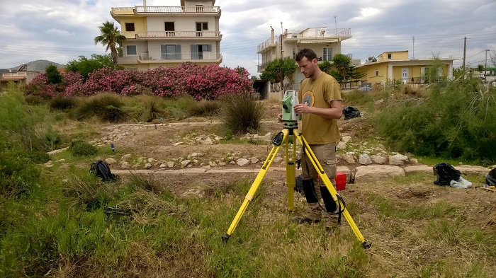
The aerial survey of the research area is carried out using a radio-controlled drone. Free satellite data is used to create an initial digital elevation model of the wider study area. All architectural surveying and documentation is fully georeferenced and was carried with total stations and photogrammetry in three dimensions. Dr. Ann Brysbaert who has experience in the employment of these methods since 2009 aided in the training of both the Leiden and the Finnish students. Especially Daniel Turner and Yannick Boswinkel were active in employing both the methods in the field and learned to use the necessary software programmes for subsequent data processing in the afternoons: the field data collected during the mornings are directly linked to GIS, CAD and photogrammetry software for further analysis immediately during the fieldwork season.
The field training at Salamis is very much hands-on and instant: this means that after a period of two weeks each participant is able to pass on the knowledge obtained to other trainees and, as such, the field training programme forms a very valuable first step in architectural and landscape documentation for all archaeologists.
Modern Greek at Nia and Argolid field trip
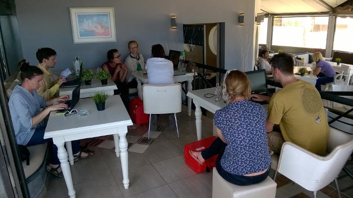
For about 10 days following the field training programme, the team, now joined by Victor Klinkenberg, took part in a very intensive course in Modern Greek, organised by the Netherlands Institute at Athens (NIA) where they received daily about 4-5 hours of classes and continued from there with several hours of practical homework tasks. The team members consider the knowledge of Modern Greek crucial for their research on Bronze Age monumental architecture and ancient economy since an important part of the vital literature is published in Greek as well as in German.
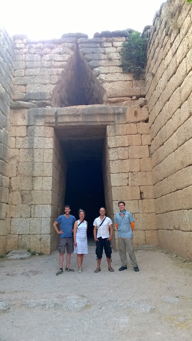
Immediately after the Greek course, a short field trip to the Argolid, especially visits to Mycenae, Tiryns and the Nafplio Archaeological Museum, brought everyone up to speed with the scale and types of architectural and landscape features to be studied over the coming years.
Fieldwork for the individual projects was started after this trip and will be reported on in the near future.
Finally, our activities at Salamis also made it to the Finnish National News broadcasting channel.