
PhD project
Cities of the Roman Near East
The main objective of this research is to map out the cities of the Roman Near East in the imperial period, with a focus on location, city size and urban features, in order to study the form the urban system and its levels of integration.
- Contact
- Paul Kloeg
- Funding
-
 ERC Advanced Grant
While the period of Seleucid and Ptolemaic control left a strong mark on the urban landscape of the Near East, the cities of the east were certainly not left untouched after Roman annexation. Even though there were relatively few new Roman foundations of cities in the eastern provinces, over a period of several centuries significant changes took place in the size, function and monumentality of the cities in the East. This project aims to study how, where and why these changes took place, to gain a better insight into how the urban systems in various regions of the Near East related to each other.
This project studies the cities of the Roman Near East, with a focus on the second and third centuries CE. With a rich earlier history of urbanism, the region stands out within the empire because of the sheer longevity of some of its cities. Most of the cities in the Roman period could be traced back at least to Hellenistic foundations, and in quite a few cases to far older settlements. By themselves, while in some respects following earlier urban patterns,
the Roman cities still show a clearly distinct trajectory
from the preceding periods.
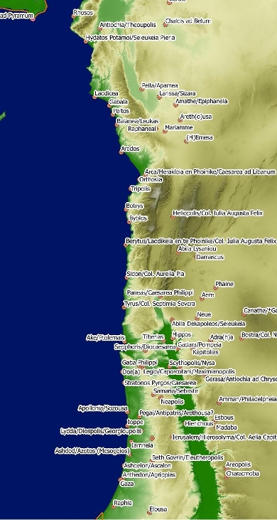
While a significant effort was already made in Jones’ Cities of the Eastern Roman Provinces (1937, 1971 2 nd ed.) to study the urban network of the east, subsequent research into this has been limited, with most studies focussed on single cities or limited regional areas. Based on these however, a far greater level of detail can be achieved than that present in Jones.
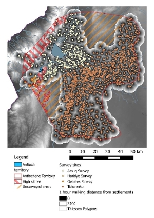
This research tries therefore to determine the shape and size of the urban network(s) in the Near East as they developed under Roman control. To do so, a spatial database is being created using QGIS to record features such as city size, public buildings, civic status and coinage in order to analyse various patterns to be found in the urban system, and also allowing empire-wide comparisons in a later stage of the research. It is hoped that, combined with various case studies, network and rank-size analysis, this will also allow further insights into regional hierarchies and levels of integration between the cities.