Research project
Seascape Corridors: How modelling routes through the sea can illuminate early island culture
What are the capabilities or limitations of traveling between islands and how does this reflect seasonal variation? Is it possible to show higher levels of connectivity between islands based on generated pathways between several sites on two separate islands?
- Duration
- 2013 - 2017
- Funding
-
 NWO Island Networks Project
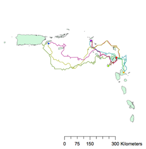
Seascapes—or the maritime-based relationship between physical environment, movement, and cultural space— have often been overlooked in studying prehistory.
When viewed through the lens of landscape theory, they are marginalized and interpreted as a blank space in which movement occurred but largely remains archaeologically untraceable. This problem is compounded when one considers that islands within larger chains, such as the Lesser Antilles, must have relied heavily on waterways to transport material and provide cultural exchange. Understanding these possible sea avenues may provide insight into which islands were connecting hubs and which conditions best facilitated travel and, thus, cultural expansion.
In order to evaluate these connections I will be using computer-based modelling programs, such as ArcGIS, which is an underutilized technique in modeling prehistoric and early historic movement on the sea. GIS can provide ways of independently modelling networks of interaction that can be checked against physical archaeological evidence of connectivity, such as the presence of foreign materials and the known distribution of sites. GIS can also assist in determining possible seasonal variations in travel, identifying stop-over locations, and analysing the cultural and energy expenditure costs of sea travel.
As part of my analysis I will focus on modelling movement based on variables such as currents (pre-contact) and prevailing winds (post-contact), equivalent to those used for anisotropic Cost Surface Analysis on land. By evaluating the effect of currents on travel, it may be possible to judge not only where people would have steered their boats but also distinguish between seasonal travel and cultural mobility patterns, which may have affected the use of sea corridors before and after Columbus’ arrival in 1492.
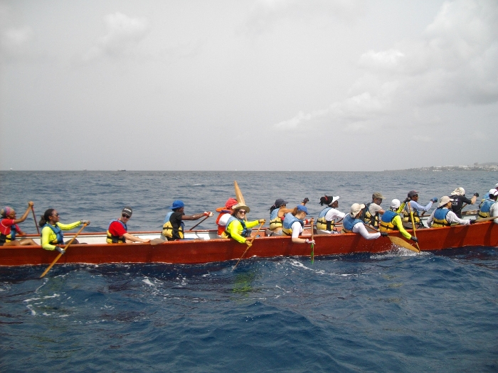
In turn, the dichotomy in pathways can illuminate some aspects of prehistoric life on and understanding of the sea, such as changes in navigation and attitudes towards seafaring. In this way, the reality of seascapes and the canoe as a mobile site from which people fully interacted with their maritime environment can be better envisioned than if relying on archaeological evidence alone.