Book
Voorburg-Arentsburg
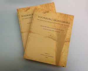
In this publication the results of the analyses of the Roman harbour of Voorburg-Arentsburg (NL) are presented. This fully inclusive and integrated study of more than 1000 pages is published in two volumes. The publication is written in Dutch, but has got an extensive synthesis/summary in English.
- Author
- Mark Driessen
- Date
- 01 January 2014

Excavations in Voorburg-Arentsburg
This publication presents the results of the 2007/2008 excavations in Voorburg-Arentsburg. The first systematic excavations in Voorburg-Arentsburg - situated along the Corbulo canal between Rhine and Meuse rivers – begun by Caspar Reuvens (Leiden University) in the 19th century. Reuvens’ and Jan Hendrik Holwerda’s excavations in the early 20th century (RMO), uncovered structures of a Roman planned settlement with a surrounding wall plus ditches, a rectangular street grid and lay-out and large Roman public baths. This site was initially interpreted as a fleet station of the classis germanica, and later on reinterpreted as the Roman town Forum Hadriani, which served as the capital for the civitas of the Cananefati. The hand of the central Roman authority can be felt all around the coastal delta area of the Low Countries. This varies from infrastructural adjustments, building and keeping up the frontier line with all kind of military installations, to the construction of new planned towns.
Excavations carried out in three large trenches in 2007/2008 were undertaken in the expectation of examining two - possibly three - insulae of this Roman town in Voorburg-Arentsburg. It surprised us when the excavations in two trenches uncovered a river channel 110 metres in length with a tapering width of at least 41 metres in the south and 28 metres in the north. In the second and early third century this Voorburg river channel was dredged at least three times, in order to transform this into a harbour basin of the desired proportions. The last seems to be the case as the channel is on the northern, western and eastern side by quay installations. The base of these quay works consisted in large pointed straightened oak posts which were driven in the ground. Two construction phases can be distinguished, one around 160 CE and a second phase around 210 CE.
The location of the harbour of Voorburg-Arentsburg – between the Rhine and Meuse near the North Sea coast which lacked natural harbours - and the nature and provenances of the retrieved materials fuelled the idea that this harbour was not only laid out to supply this central place of the civitas Cananefatium. The harbour was pivotal in the provisioning of the military in the coastal zone of the West Netherlands, but was constructed as well for supra-regional aims. Our natural coastal delta with favourable off-shore winds and currents will have stimulated not only the Roman coastal trade, but most probably also that to and from Southern and Northern Britain. This study provides enough arguments to suggest that the Roman harbour of Voorburg-Arentsburg played a role in the transit routes towards Britannia.
Order hardcopy via UvA or digital copy via Mark Driessen
