

New dataset helps to understand environmental impact of offshore windfarms
While offshore wind farms generate clean and green energy, scientists are becoming increasingly aware of the harmful impact they may have on marine life. To get a better overview of these impacts and to find the best locations for future wind farms, environmental scientist Yali Si and her colleagues put together a freely available dataset comprising all wind turbines on the globe.
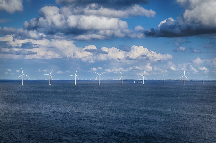
Wind energy is a popular source of renewable energy. In recent years, 14 coastal countries worldwide built no less than 6,924 wind turbines to reduce greenhouse gas emissions and make the first steps towards a net-zero carbon economy. Nevertheless, says Si, the potential environmental impacts of offshore wind farms are currently still under debate. ‘They should be further investigated.’
Protecting a vulnerable area
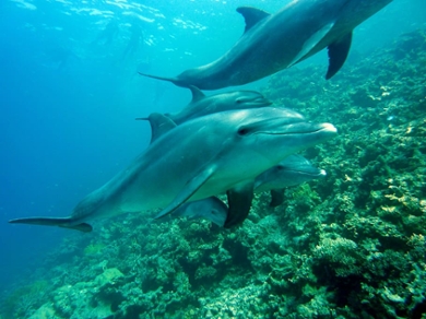
Most wind farms are located close to the coast. A highly vulnerable area, as it’s home to a big variety of marine flora and fauna. For those species, not only the construction of these turbines can have a great impact, but also the presence and noise of the established turbines can be really disturbing. Si: ‘We gathered information about the spatial distribution and construction trajectory of all wind turbines world-wide. Our database is freely available and will be updated annually. It will be useful for assessments of the environmental impact for new offshore wind farms yet to be planned and built.’
35 databases but none satisfies
35 databases with data on offshore wind turbines already existed. But, according to Si and her colleagues, none of them meets all the requirements. ‘Not all of them are freely accessible,’ she explains. ‘And the free ones have obvious omissions of turbine numbers, or recording errors with wrong locations. Others don’t have global coverage or lack updates of the latest installations, or information about the precise locations.’
Sending microwaves from space
Si disclosed the exact locations of the wind turbines by using data from the Sentinel-1A/B satellite. This satellite has a state-of-the-art way of imaging objects on Earth, called SAR (synthetic aperture radar imagery). Si: ‘Unlike optical imaging, which relies on sunlight for illumination, SAR is an active process that beams microwaves down to Earth. Some of those beams bounce back to the satellite, where data on the polarisation and intensity of the backscatter is captured (see frame).’ The microwaves can penetrate clouds and fog, and can supply detailed images even in the dark. Thereby SAR sensors can collect data regardless of weather and time of the day.
Backscatter
When an outgoing radar signal hits a target, a portion of the signal redirects directly back towards the radar antenna. This portion is called ‘backscatter’. The presence of dihedral structures, such as wind turbines, results in a drastic increase in backscattering. That’s how a wind turbine stands out from the sea surface.
Dihedral what?
Dihedral structures consist of intersecting planes that make an angle. In this case, two intersecting blades form a 120-degree angle, which forms a dihedral structure.
A multi-layered approach
Sentine-1 took a grand total of 737,100 SAR images. To avoid mistaking mobile objects, such as ships or floating platforms, for wind turbines, the satellite took multiple pictures of the same locations over a whole year’s time. This resulted in multiple ‘layers’ of data on the map of the Earth. ‘In Google Earth Engine, we calculated the mean of all these layers and put them together into one single layer’, explains Si. ‘Within this mean layer, we searched for the locations that had relatively high values: meaning there was an object present for a big part of the year. This way, we could remove floating or temporary objects from our list. Only wind turbines occupy a location substantially longer!’ The researchers then applied a special algorithm to further extract the objects with high backscattering: the wind turbines.’
Up-to-date and up for a change
Where aerial imagery always lags behind the installation of new wind farms by several months, data from Sentinel 1 is very up-to-date. The new database is therefore much more useful for analysing regional variations and the impact of current offshore wind farms. Si: ‘We hope that can offer import insights for risk mitigation and new turbine siting. For example, the conflict with wildlife could be more accurately investigated by combining our data with data on species distribution and movement marine species.’
Paper
The global offshore wind farm dataset will be updated annually and is currently free to download via Figshare.
Read the whole paper: Zhang, T., Tian, B., Sengupta, D., Zhang, L. & Si, Y. Global offshore wind turbine dataset. Sci Data 8, 191 (2021).