
New regional pesticides atlas developed
A new regional atlas, with information about the presence of pesticides in surface waters, has been developed by the Institute of Environmental Sciences (CML) in collaboration with Royal Haskoning DHV. The aim of the regional pesticide atlas is to support decision making at local and regional levels, with farmers, agricultural companies, waterboards etc., in order to improve the water quality.
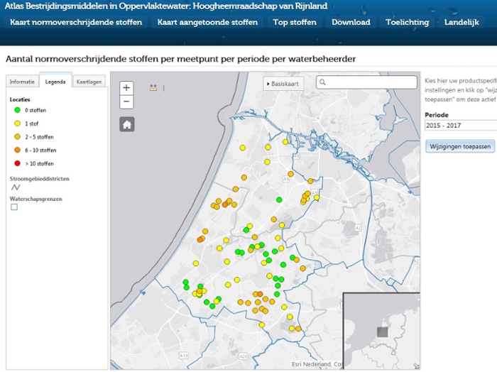
For each waterboard a map is available with the number of standard exceeding substances per sampling point (see map). Also the main types land use can be added easily to the map, so that a first simple visual linkage can be made between agricultural land use and presence of pesticides in the surface waters.
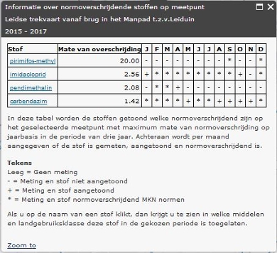
Each sampling point can be clicked on, and then a pop up screen appears with a table with the standard exceeding substances, the maximum amount of exceedance and the months in which these exceedances occur
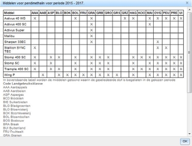
The substances in this table can also be clicked on and then a second table appears with for the chosen substance the commercial agents and the crops in which they are permitted.
In this way all the responsible actors have access to easy to understand information between presence of pesticides in the surface waters on the one hand and the possibly responsible commercial agents and relevant crops possibly on the other hand.
This is the necessary first data driven approach for a step-by-step improvement of the water quality. Besides the tools described above, also other tools are available like the top ten problematic pesticides per waterboard.
Regional Pesticides atlas
The regional pesticides atlas (in Dutch) is freely accessible