Research project
Triceratops Bonebed Excavation
Since 2013, the National Natural History Museum of the Netherlands, Naturalis Biodiversity Center, is unearthing the largest bonebed of the horned dinosaur Triceratops discovered so far. In order to answer questions about sedimentology, taphonomy and palaeobiology, palaeontologists and geologists collaborated with archaeologists to share methodologies on 3D data registration and documentation in the field.
- Duration
- 2013
- Contact
- Roeland Emaus
- Partners
- Luca Brunke, Tubingen University
- Pim Kaskes, Vrije Universiteit Brussel
- Dylan Bastiaans, Naturalis Biodiversity Center
- Anne S. Schulp, Naturalis Biodiversity Center

Excavating Complex dinosaur bonebeds
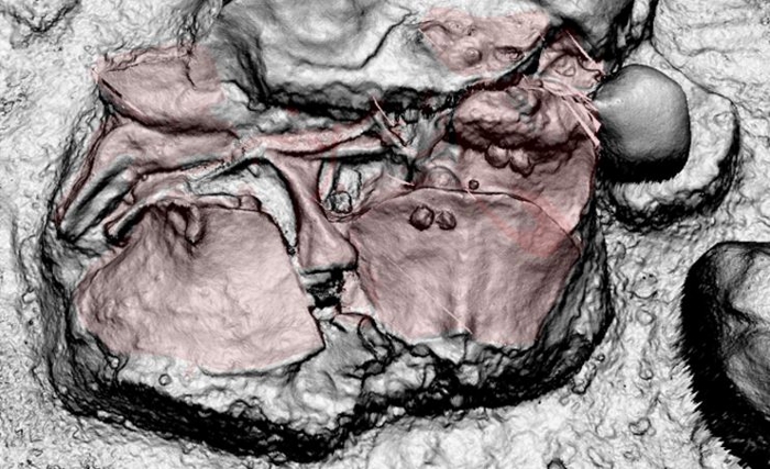
Since 2013, the National Natural History Museum of the Netherlands, Naturalis Biodiversity Center, is unearthing the largest bonebed of the horned dinosaur Triceratops discovered so far. At least six individuals of Triceratops have been identified and more than 1000 bone elements have been uncovered from this site of the uppermost Cretaceous Lance Formation (69 to 66 mln. years old) in eastern Wyoming, USA. The bonebed consists of in-situ disarticulated skeletons chaotically positioned on top of each other and embedded in a variable matrix of organic rich silt and claystones and interfingering fluvial sandstones.
When dealing with complex bonebeds, traditional 2D-grid bone mapping does not capture the full complexity of the fossil locality. In order to answer questions about sedimentology, taphonomy and palaeobiology, palaeontologists and geologists collaborated with archaeologists to share methodologies on 3D data registration and documentation in the field.
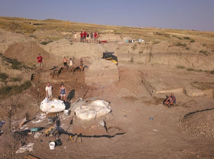
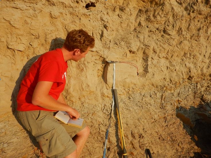
LiDAR imaging creates a textured digital elevation model of 30x30x10m for the Triceratops bonebed. Drone photogrammetry is used to document the ongoing excavation progress and to allow stratigraphic correlations with sections close by. Geological samples are taken to analyze grain-size, organic content and elemental composition, in order to map the heterogeneity of the sediments surrounding the bones. A GPS rover and a Total Station, commonly used in archeology, are combined to record the x, y and z position of every bone element and lithostratigraphic section. This replaces the traditional 2D grid mapping of bonebeds. In addition, prepared bones are 3D scanned to place them volumetrically correct in their original burial position.
An accurate 3D-registration of the site, using daily UAV- and close-range photogrammetry combined with Total Station, DGPS-survey, previous year’s laserscanning and 2D bone mapping provided the needed 3D spatial dataframe. Using this methodology we can be able to fill the 3D-cube as for the geological context. Also, by recording geological samples from surrounding outcrops we can get a more complete picture of the wider landscape, going further back in time. The used methodology and workflow have shown to work on sites with complex taphonomies and can be applied to other excavations, both palaeontological and archaeological.