

Exceptional collection of maps and atlases donated to Leiden University Libraries
Private collectors John Steegh and Harrie Teunissen from Dordrecht have donated their entire collection of maps, city plans and atlases to Leiden University Libraries (UBL). In almost 40 years they brought together circa 17,000 map sheets and 2,300 atlases and travel guides. Especially the thematic maps from the 19th and 20th centuries can be considered as an important addition to the map collections of UBL. Although Steegh and Teunissen don’t live in Leiden anymore, they still feel strongly connected to the city and its university.
Collection Steegh-Teunissen
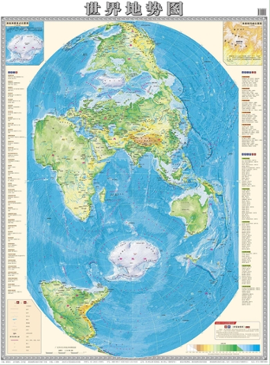
The collection consists of maps from all parts of the world from the 16th century to the present day, but with emphases on the 19th and 20th centuries. It probably is the most comprehensive private map collection in the Netherlands. The main themes in their collection are water management, city development, ethnic relations, and military conflicts. They aim for a wide range of cartographic forms, including propaganda and advertisement maps. They also collect present-day maps. Top pieces are, among others, wall maps of the hoogheemraadschappen (water boards) of Rhineland from 1687, Delfland of 1712 and Schieland of 1928, Ottoman maps, maps of Palestine and Israel, some 140 city plans of Leiden and several rare Nazi and Jewish maps of the Holocaust. Unique is a secret German city plan of Warsaw from 1939 on which the SS draws the contours of the planned Jewish ghetto in November 1940. A recent purchase was a Soviet map of Berlin, which was used during the capture of the Reichstag on 30 April/1 May 1945.
Maps as a passion
John Steegh was a civil servant, member of the States of South Holland, loco dike warden of Rhineland and an alderman of Leiden. Harrie Teunissen was a scientific assistant at the University of Amsterdam and a cultural and religious historian of Judaism and Islam. They share their passion for the history of the production and use of cartographic documents. they regularly give lectures based on selections from their collection. In 2003 they compiled the exhibition Balkan in kaart: vijf eeuwen strijd om identiteit (Balkan in maps: five centuries of struggle for identity) in the University Library. This exhibition was largely based on maps from their collection, complemented with maps from the Special Collections of the UBL. They organized eleven other expositions with their maps, such as Kaart als Kunst (Map as Art) in Museum De Lakenhal in Leiden (2009) and East of Auschwitz in the Riga Ghetto Museum (2013). The exhibition Moderniteit in kaart. Mapping Modernity in the Design Museum in Den Bosch is in preparation, the opening is planned for February 2023.
‘Our collection is unique in various fields, so it would be a shame if it were to fall apart after our deaths. We don’t have children and don’t want to burden our family with such a large and difficult inheritance. Moreover, the collection can be of great importance for education and research in various fields of study. We have maintained fruitful contacts with the map curators of UBL for decades. Our thematic interests and way of collecting fits well into the Bodel Nijenhuis collection, which is already in the library, and supplements this exceptional collection from the 19th century to the current day. In this way, we are able to give something back to the city and university where we have felt at home for 40 years.’
John Steegh and Harrie Teunissen
-
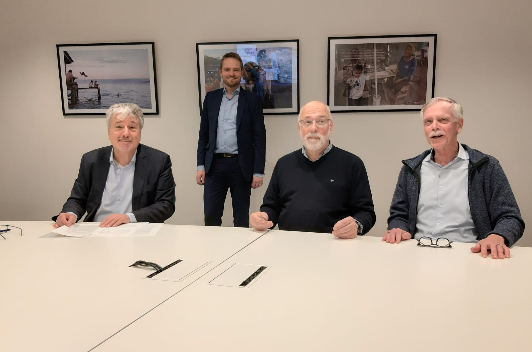
Signing at the Leiden University Library -
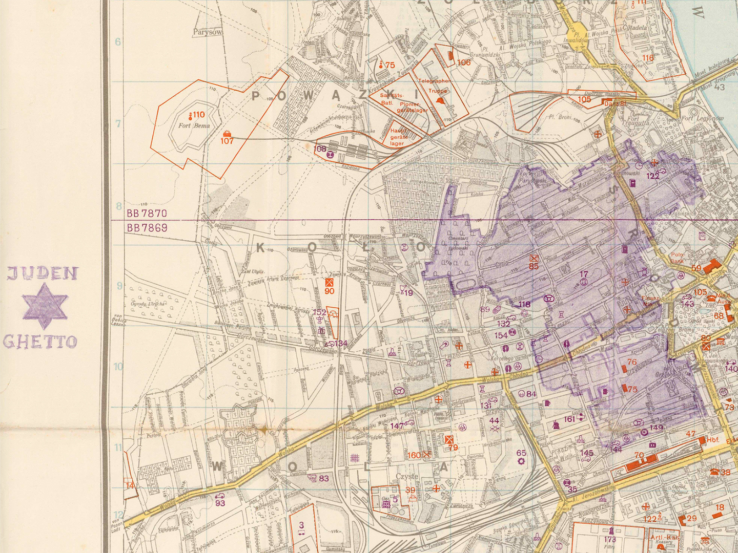
Cutout of map of Warshaw with pencil drawing of ghetto -
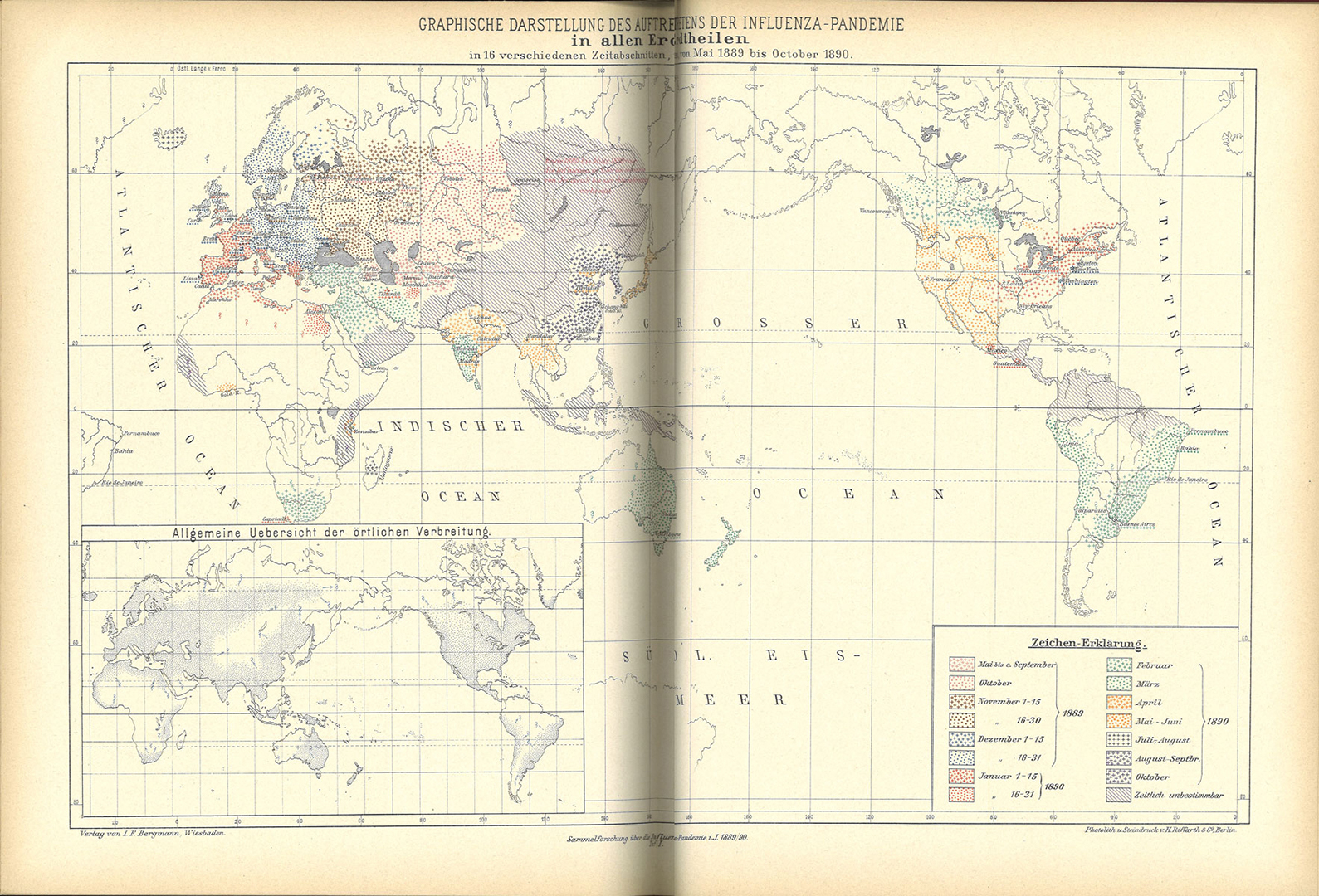
Map of (corona)pandemic 1889/’90 -
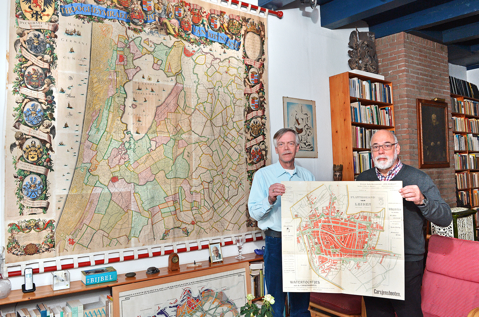
Map of Rijnland from 1687 and Plan of Leiden from 1911 (photo: Sander Pardon)
Bodel Nijenhuis Fund
Concurrently with their donation, John Steegh and Harrie Teunissen have co-founded the Bodel Nijenhuis Fund – named after the great Leiden map collector Johannes Tiberious Bodel Nijenhuis (1797-1872) – to the benefit of the cartographic collections of UBL. This fund, founded at the Leiden University Fund, is aimed at the continual enrichment of the collection with appropriate acquisitions, but also to make these available for a worldwide audience of academics and interested peoples, through digitisation and conservation.
‘I am extremely grateful to John Steegh and Harrie Teunissen for the beautiful collection which they donated to UBL. Exactly 150 years after the collection of the Leiden collector Bodel Nijenhuis laid the foundation for our cartographic collections, this donation once again enormously enriches our collections as well as the research and education which connects with various themes that this especially rich top collection carries within itself.’
Kurt De Belder
University Librarian
Director Leiden University Libraries
Cartographic collections UBL
The foundation for the cartographic collection of UBL was laid by Johannes Tiberius Bodel Nijenhuis. When he died in 1872 – next year exactly 150 years ago – Bodel Nijenhuis bequeathed his collection of 50,000 maps and atlases to the University Library, including hundreds of unique, hand-drawn maps. The collection grew in the past century and a half with numerous donations and purchases. In 2013 and 2014 the collection was considerably expanded with the map collections of the Royal Tropical Institute (KIT) in Amsterdam and the Royal Netherlands Institute for Southeast-Asian and Caribbean Studies (KITLV) in Leiden. Today, UBL keeps one of the largest collections of maps and atlases in the Netherlands, with a strong international character. The collection is an important source for education and research in various disciplines and is intensively used for digital presentations and exhibitions in the Netherlands and abroad.