
The KU Leuven Dayr al-Barsha project
Update : March 2020 Director: Professor Dr Harco Willems (KU Leuven), co-director Dr Marleen De Meyer (KU Leuven & NVIC)
This project began in 1988 as an initiative of Harco Willems, then working for Leiden University. The original intention was to publish the field records of Reisner’s expedition in 1915 in conjunction with an epigraphic record of some Middle Kingdom tombs. Because Reisner's records are kept in the Museum of Fine Arts, Boston, a joint mission was started with that museum and the University Museum at Philadelphia; this collaborative effort realized one field campaign (1990). After hibernating between 1992 and 2001, the project, now based at KU Leuven, was restarted. It is mainly funded by the Research Foundation - Flanders and the Special Research Fund of Leuven University, but also by international funding agencies.
The project aims to provide a regional description of the archaeology of the region around Dayr al-Barsha, the southern limit being at al-Shaykh Sa’id and the northern one at Dayr Abu Hinnis. A main focus of attention is the cemeteries at the desert fringe in this entire area, which span the period between the Third Dynasty and the Graeco-Roman Period. Current research interests include the spatial distribution of the many cemeteries and settlements in the region, the reconstruction of the landscape, and digital reconstruction of monuments. Based on surface surveys, ground- and satellite-based remote sensing, targeted excavations, and epigraphic work, the project is generating site histories of each of the cemetery sites in the region, in order to establish a basic demographic profile of the buried populations. Preliminary results can be summarized as follows.
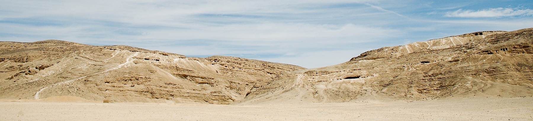
In the Third Dynasty, a poor but huge cemetery emerged on the hill slopes between northern Dayr al-Barsha and Dayr Abu Hinnis. Later in the Old Kingdom (as of the Fifth Dynasty, but mainly in the Sixth) several rock cut tomb cemeteries emerged on the north and south flanks of the Wadi Nakhla (in Dayr al-Barsha). At the same time, an important cemetery for provincial governors, which is now being investigated, emerged at al-Shaykh Sa’id. In the First Intermediate Period a cemetery of the highest elite emerged in what is now the village centre of Dayr al-Barsha. In the Middle Kingdom a vast cemetery extended from here across the desert plain to the hilltops further east, the latter area being occupied by the nomarchs' tombs. In the Second Intermediate Period and Early New Kingdom, poorer burials were mostly deposited in older tombs. After this, burial activity stopped almost until the Late or Ptolemaic Period. Probably the main provincial cemetery was now moved to Tuna al-Jabal on the west bank. Extensive late cemeteries exist, however, near al-Shaykh Sa’id. All these cemeteries must relate to settlements in the Nile Valley.
Reconstruction of this landscape is currently being undertaken, the aim being to contextualize the cemeteries within its floodplain environment. Therefore, geomorphological research is now also being carried out on the west bank, in collaboration with geographers of KU Leuven.
Research is also focusing on ancient economic activity in the region, most notably quarrying. In collaboration with historians of KU Leuven, the vast limestone quarries from the time of Nectanebo I in the Wadi Nakhla, which among other things contain hundreds of demotic graffiti, are being recorded. At al-Shaykh Sa’id, quarry and stone processing activity dating back to the Fourth Dynasty is being investigated. Here probably a royal domain of that date existed. The site was later re-used between the Amarna Period and the Late Period. Most importantly, a recent initiative is the investigation of the Amarna Period quarries in the entire region. Although some exist near al-Shaykh Sa’id, the most important cluster extends between Dayr al-Barsha and Dayr Abu Hinnis. This is currently being mapped and the texts, bearing on the building history of Amarna, are being recorded.
The area also contains extensive testimony of early Christian activity. Study of this has mostly focused on the laura and rock church of John the Baptist at Dayr Abū Hinnis.
The latest research initiative, started in October 2017 in collaboration with the KU Leuven technology campus at Ghent, is to develop geomatic tools to digitally reconstruct the original shape of the area of the Middle Kingdom nomarch tombs, as well as these tombs themselves. This will i.a. result in a new publication of the tomb of Djehutihotep.